Contents [hide]
Intro
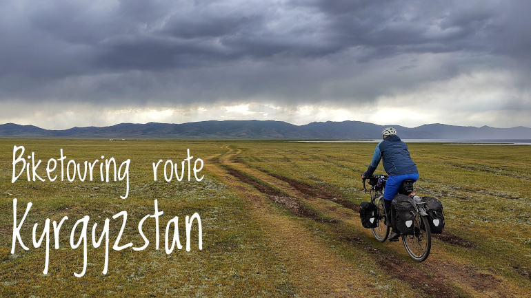
Kyrgyzstan is all about mountain nature and alot of high mountain passes. There’s going to be a lot of gravel roads if you want some scenic experiences. And when you see an asphalt road after battling with bumpy mountain roads for several days, you want to kiss that asphalt. But trust me, it’s all worth it. Just remember to set aside time to do your daily mileage. Kyrgyzstan is slow travel at its best.
You’ll encounter the traditional yurts on the mountain sides and greet friendly kids with high-fives. There will be loads of free running horses and herds of sheeps and cows grazing on the lush plains of the mountains. You probably will also have the chance to try fresh horse milk but be warned - it’s an acquired taste. It all adds up to the Kyrgyz magic.
This country is made for looping around and taking detours in all directions but if you are like me and crossing through the country from Uzbekistan to Kazakhstan you can take inspiration from this trip report with GPX files, detailed road descriptions and an interactive map with points of interest.
GPX files
Get the GPX files here:
Route stats
- Distance (km): 821
- Elevation (m): 9612
- Road days: 11-12
- Highest point (m): 3449
- Time of year (month): July
- Navigation app used: Mapy.cz
Highlights
My favorite highlights from Kyrgyzstan. These ones are all about nature. Cities and towns were not at all interesting so I was only stopping by to take a rest in a Guesthouse and re-supply for the next mountain pass. If you are a fan of nature like me you will get highlights almost wherever you cycle. However, below is a list of my favorites and I almost guarantee you will not be disappointed if you include these on your route.
- Kaldamo Pass
- The Kazarman-Chayek valley road along the Naryn River
- Kara-Keche Pass
- Son-Kul Lake
- Kalmak-Ashuu Pass
Map with Points of Interest
The map contains points of interest (POI) on the route I cycled. Click on the marker for a detailed description. The list of POIs include places where you can eat, sleep, stock up on water and more. It also shows you where to buy a SIM card and other useful stuff.
The POIs were correct as of July 2023 so take this into consideration when you plan your own travels. Things change fast in this dynamic world. As always, I’m happy to receive feedback if any of the info given is not correct or up to date.
Section 1: From Osh to Kazarman via the Kaldama Mountain Pass
- Route: From Osh to Kazarman via the Kaldama Mountain Pass
- Distance (km): 257
- Elevation (m): 3800
- Highest point (m a.s.l): 2987
- Days: 4
From Osh to Jalal-Abad: 103 km with 693 meters of elevation with easy gradient. Can be done in 1 day. Roads are in good condition with some traffic but you will be spared for a convoy of trucks. A less scenic part but the view of the Andijan Reservoir is nice.
Leaving Osh is a bit hectic but manageable. It's quickly done. Once you're out of the city you'll have urban farming scenery until you get a glimpse of the Andijan Reservoir to your left after passing bustling Özgön. From here until Jalal-Abad the golden hills will rise up. The soft wavy curvature is hypnotizing to gaze upon. If you look around there will be snow covered mountain tops giving a good idea of what to come. Pay attention to the super cool Kyrgyz hat that you'll see men wearing - it's white and tall with some black pattern.
The roads are in good shape. Smooth and fast asphalt but no shoulder. The roads are for the most part wide enough for the cars to give good clearance. Traffic is busy and big trucks will pass from time to time but considering it's the main road connecting the cities of Jalal-Abad, Özgön and Osh it's actually not too bad.
There’s not much other route choice than following the main road. Enjoy the tarmac because up next is long stretches of gravel. There's plenty of markets and restaurants along the way. Even though the route has some hills you can do Osh to Jalal-Abad in one long day and don't need to carry food or a lot of water. You can replenish along the road.
Wild camping on this stretch can be difficult. Your best bet is to find a spot near the Andijan Reservoir. Just be aware that you are in a border region. I would recommend continuing onwards and booking a room at Hotel Good Night. This accommodation is run by a lovely lady and has the sweetest staff. Breakfast is amazing. You deserve to treat yourself before heading into the mountains.
From Jalal-Abad to Kazarman: 154 km with 3107 meters of elevation with easy gradient except for the switchbacks where you will have to get your mountain legs to work. This one is tough but very scenic. Easy in the beginning, then challenging on the gravel road through the valley and very strenuous on the switchbacks up to the Kaldama Pass. As a reward you will get stunning views of the valley and mountain peaks on almost car free roads. On your way you will see several yurt camps and give high fives to some cheering local kids. It’s mountain nature at its best and all well worth it. You do it 2 days if you are super human and otherwise 3 days.
There are some backroads available to get you out of town and towards the mountains. The main road should be the one with the least elevation though. Expect some traffic if you go for the main road but you will be spared for the heavy trucks (I don't think a single one passed me). The traffic slowly diminishes as you approach Taran-Bazar. As you cycle out of Jalal-Abad the yellow golden wheat fields fill up the flat parts of the valley. But not for long. You gradually get to see the snow capped mountains to your left and in front of you as you progress. After Taran-Bazaar you turn left and cross the river and continue up to the nearby village 10 km away. This is the last relatively big settlement until you have crossed the pass. You now enter the valley with a gorging river twisting and turning its way down from the higher mountains. People do live in the valley and they are scattered frequently along the river so the mountain road is not completely deserted. In fact you will see fenced off farm land areas. They live in what looks like rusted old railway wagons and some also have yurt camps. Expect nice Kyrgyz people that will wave and cheer you on and cows and horses roaming the gravel road looking curiously at you as you cycle pass. Continue to climb slowly up and up and up through the valley. You'll follow the river for most part until you reach a big wall of a mountain ahead of you which you need to pass. This is where the switchbacks begin up to the Kaldama Mountain Pass at close to 3000m. As you climb up you'll be rewarded with amazing views of the green lush valley and the high snow capped mountain peaks. Take your time to soak it all up. You can camp at the top which I highly recommend as long as you are prepared to deal with some chilly night temperatures and windy conditions. Be aware that weather up here can change for the worse very fast. After the pass you have a long descent to Kekerim village. It’s a challenging downhill section where you need to control your speed so you don’t slide off the road. You will pass several yurt camps with awesome kids giving you high fives and if you are lucky a beekeeper offering you some delicious honey from their own stash. There are no spectacular mountain peaks on this side. Only lush valley hills with an abundance of flowers. There will be some smaller climbs on your way to Kekerim. From Kekeri to Kazarman you have an easy ride. There are guesthouse options in both places so decide if you want to stay in quiet Kekerim or the more active Kazarman. There are no eateries (only mini-markets) in Kekerim so you will have to ask the guesthouse to prepare your food.
The first 40 km to Taran-Bazar have good quality asphalt without potholes and cracks. You will not have a shoulder to cycle on but traffic flows easily and slowly around you. After Taran-Bazar you cross the river and continue 9 km more on asphalt road and then the gravel road begins. The gravel road is medium good. Doesn't have any potholes or washboard surface but there are some larger stones from time to time. The elevation gradient up through the valley is low but once you begin the switchbacks it increases. All in all the gradients on the switchbacks are mellow enough to cycle. There's just parts with big rocks where I pushed instead. The pass is closed in winter time from September to May. If you plan to cycle in the beginning or the end of the season, ask about the conditions before venturing for the pass. After the pass you have some decent and fast gravel road all though you're clenching your brakes still to keep yourself safely on the road. Once you have done most of the descent the gravel road turns to the worse with bigger rocks and washboard surface. Look forward to a paved road once you reach Kekerim which will last all the way to Kazarman except for 3 km of gravel.
There’s a new road being built between Taran-Bazar and Kazarman that bypasses the mountain pass but the tunnel connecting the two parts of the roads is not completed yet as of summer 2023. However, even though you can take the tunnel at one point in time, going for the scenic Kaldama Pass is well worth considering. Tunnels are dark places of doom anyways (yeah, I am not a very big fan of tunnels while cycling) so perhaps the choice is an easy one.
Wild camping is easy between Taran-Bazar and Kazarman. There are several fenced off places but there are also frequent opportunities to find a somewhat flat piece of grass on an open field or next to a tree. Ask the locals in the area for guidance if needed and if you camp close to a fenced off area find a nearby friendly farmer to ask for permission (they would never say no). Just before the switchbacks to the mountain pass begins you will have a last option to find a decent spot. Once you begin the switchbacks you have to go almost all the way to the top. I camped 5 km from the top with an epic view (highly recommended). You can also camp at the very top of the mountain pass. Just expect a lot of cars to stop here to admire the view. Remember to bring a warm sleeping bag and fill up your water bottles from the nearest spring. On the descent to Kekerim village you will find several good options close to the river and on flat grassy parts after you have done the switchbacks. There are yurt camps during the switchbacks so if you are tired and dizzy from all the turning I’m sure you can pitch your tent next to a classical yurt and make some good friends during the evening. There are guesthouses once you reach Kekerim and Kazarman.
You have several markets where you can buy water and food from Jalal-Abad to Taran-Bazar and then your options are limited until you reach Kekerim or Kazarman. While cycling in the valley you will find water springs. On the switchback section up to the mountain pass coming from Jalal-Abad, I was surprised to only find one water spring which was almost at the top. On the descent to Kekerim and Kazarman I spotted one water spring as well (which is marked on the map). I guess there are more springs if you look around but these are the ones I could clearly see while cycling on the road.
O! coverage was good with 4G between Jalal-Abad and Taran-Bazar but after you cross the river close to Taran-Bazar you'll have weak 4G signal for some 15 km more and then no coverage at all down in the valley. As you climb up to the mountain pass you will get good 4G cover as you get closer to the top. On the descent you have on and off coverage but it’s good again once you are in Kekerim.
Section 2: From Kazarman to Son Kul via Chayek
- Route: From Kazarman to Son Kul via Chayek
- Distance (km): 253
- Elevation (m): 4125
- Highest point (m a.s.l): 3372
- Days: 4
From Kazarman to Chayek: 121 km with 2160m in elevation over many smaller rollercoaster hills with all asphalt paved roads. No gradients above 8%. Two easy days of cycling or one long day. This route was a last minute change for me. I was originally headed to Son Kul over the Moldo-Ashuu Mountain Pass south of the lake. Instead I approached Son Kul from the west over the Kara-Keche Mountain Pass via Chayek. I counted five different roads leading to and from Son Kul from various directions. I’ll give you my trip report based on the Kazarman - Chayek - Kara-Keche - Son Kul route.
A hidden gem not even featured in Google Maps when I cycled this road in July 2023. It’s fresh asphalt and if you are familiar with Kyrgyz mountain passes you want to kiss the asphalt when you see it. The road is elevated above the Naryn river that flows in a valley between steep and colorful mountain sides. Very little traffic passed me during my two days to Chayek and I hope you will enjoy the same peaceful mountain traverse as I did.
You quickly exit the small dusty town of Kazarman and get the valley opening in sight as you cross the roaring Naryn river on a high pillar bridge. The roads are built high above the river in many places. If you look to the sides you can see remnants of the old dirt road running very close to the river bank. Guess experience taught them to build higher this time around. You are greeted with fresh and pristine asphalt and it makes cycling fast and easy. There’s even a shoulder to fit your bicycle in. There’s a lot of cruising up and down on roller coaster-like roads but you can easily use the momentum from a downhill ride to get you far up the next uphill section. I didn’t see gradients above 8% and the climbs are never long and exhausting. You can be tempted to do the distance in one day but I urge you to take it slow, enjoy the scenery and find a nice camping spot next to the river.
Wild camping is surprisingly easy. When I looked at the map I figured it would be very difficult to find a flat area to pitch my tent with all those steep mountain sides. And the new elevated road relative to the river made it seem even more difficult to find a camping spot. But some very convenient dirt roads frequently lead from the main road down to either the river or a flat and grassy plateau. If you don’t want to go for a spot off a dirt road you can be a bit adventurous and carry your bike down the slope if you see the perfect spot for you although I would recommend just sticking to the dirt roads.. I’ve marked some spots I figured would make for a very scenic night in a tent.
The river water is very murky so you want to get your drinking water from a clear water spring. Parts of the road have many water springs clustered together in one place and other times you will have to cycle a bit to get to the next water spring. If you plan to camp on your way to Chayek, look at the map and at my POIs to see if you can get a water spring close to your tent so you don’t need to carry the water for a long distance.
From Chayek to Son Kul: 132 km over 2 days. This part is all climbing up, up and up doing 1965 m in elevation. Be prepared for some high altitude mountain passes and fast changing weather. Getting to feel the Son Kul magic makes it all worthwhile.
The road to Son Kul starts by cycling east out of Chayek. There’s 15 km of sweet asphalt until you turn right and say hello to gravel for the next many days. Just before turning off the main road you have a small village with your last chance to stock up on some food. My main thing in Kyrgyzstan is to try as many different Nitro Energy Drinks as possible and you have a good reason to boost up for the coming climbs.
A long, straight gravel road will take you up through a valley and towards one of several mountain passes that surrounds Son Kul. It’s a very low gradient and you almost don’t feel that you climb. But you do add around 1000 elevation meters during the next 40 km. Just before the switchback begins you’ll see a big open pit coal mine. Cycling up this road has the drawback of lorries and trucks driving up and down from the mine but in all honesty it wasn’t that bad. As you climb up the switchbacks and have gained some elevation meters, remember to take a look back so you fully can appreciate all the levels of the mine and the different colors of the rock that has been exposed by all the digging. Leaving the coal mine behind you will soon cross the Kara-Keche Pass at 3384 meters. On the descent you’ll get a flat blue surface in sight which is the magical Son Kul. Reach the lake shore and take in all the cows, sheeps and horses running freely around vast green plains. Marvel at the mountains that surround the lake on all sides. I’ve seen many lake landscapes and this is a top one.
The road down to Son Kul is not a fast descent. The rather nice and even gravel on the ascend turns stony and bumpy. Set some time aside to cycle down to the lake. Also, you want to take a breather in the high altitude air and marvel at the big lake that begins to appear in the distance. When you reach the lake shore you have a group of tourist yurt camps.You can get some overpriced food (expect more than double up prices) and fill your water bottles with some drinking water. Getting water from the tourist yurts might be an idea as the lake water supposedly has an acquired taste even though you have a quality water filter.
Wild camping is best done before you reach the coal mine. If you proceed far enough up the valley, the murky river water will turn clear and you are never far away from a refreshing mountain water drink. Just remember to filter the water. Also think about if you want to drink the water below the coal mine. The locals I asked said it should be safe to drink even downstream from the mine. After the mine you will need to reach the pass before you have open and flat grassy areas well suited for a camping spot. On the descent to Son Kul is a wild camping paradise. But to pay attention to the yurts that are spread around on the flat areas all the way down to the lake. Pitch your tent in respectful distance and better yet go and say hello and ask for permission. Around the lake I’ve never had so many flat grassy ground to pick from when going for a wild camp spot. Just bear in mind that most of the yurt camps (both tourist and local yurts) are placed close to the shore and especially the touristy ones can bring a gang of men requiring you to pay money to pitch a tent even though you are far away from their yurt. Either go a bit inland or find a secluded cove on the north north-west side of the lake.
Section 3: From Son Kul to Bishkek via Kochkor
- Route: From Son Kul to Bishkek via Kochkor
- Distance (km): 311
- Elevation (m): 1687
- Highest point (m a.s.l): 3449
- Days: 3 to 4
From Son Kul to Kochkor: 100 km with a manageable 618m in elevation on low gradient gravel road up to the pass. This can be done in 1 long day if you begin early. A 40 km long downhill section on asphalt will finish off the last part very fast.
Say goodbye to the wonderful Son Kul but the spectacular mountain landscape is not over yet. One more pass to go before Bishkek and a lot of downhill parts on fast asphalt roads.But first some more gravel up, over and down from the Kalmak-Ashuu Mountain Pass at 3446 meters.
When you reach the lake from the south you might be tempted to stay on the south side and take the shorter road with the least elevation meter to the nearest exit road down to either Naryn or Kochkor. But don’t be tempted. You want to take the northbound road around the lake. On the west side of the lake you have flat plains to cycle and this was a first for me where you cycle on a grassy track. Heading to the northern side you will get some steep climbs and roller coaster roads. On this part you have some wonderful secluded coves to take a break and a cold dip in the lake if you’re up for it. On the north side of the lake, the tourist yurts have small markets selling snickers and other snacks if you get that craving. I would advise to bring your own food up here but you can easily get egg and bread for breakfast at 300 SOM and plov dinner for 500 SOM (2023 prices). So you will not starve at the lake if you forgot to bring enough food. Conquer the hilly landscape and you find yourself on flat plains again and you reach the east bound exit roads down to A365 main road. You can pick between the northern and southern roads. They both exit at the same main road. The south one makes sense if you want to go to Naryn or if you want to cycle over the Dolon Pass. The northern one makes sense if you want the shortest route to Kochkor and want to do the least elevation meters.
All the mountain landscapes are spectacular around the lake so there is not the best road to take. I took the northern road over the Kalmak-Ashuu pass. Pay attention to the weather before you go over these passes. The Kalmak pass is a high one and in less than an hour you can go from peaceful fluffy puffy clouds to black ominous thunder monsters. There seems to be a pattern to the weather. Calm in the morning and then increased risk of bad weather in the afternoon (at least that was how it was for me).
Getting up the pass is only challenging due to the technical gravel road with the occasional large stone. The gradient is mild and forgiving. Going up to the pass you have good views of the lake behind you and on the pass some majestic snow covered peaks and a dramatic descent into the valley. Be careful on the switchback descent - it’s a long roll down if you go off the road. Down in the valley there’s more settlements and houses. The yurts are gone and the valley mountains are a bit dull compared to the previous scenery. Unfortunately, there are quite a lot of washboard surfaces on the way down to the first village so your wrist will take a beating. Pass the little village and do one last climb before you will be ever so happy to see asphalt again. Now you have 40 km of pure downhill to Kochkor and the valley scenery probably is nicer than you would expect. At the beginning of the downhill section there’s an intersection rest stop at Sarybulak. It’s only a collection of eateries and a supermarket but you want to stop here to take a break and sip your favorite flavor of Nitro Energy Drink and eat some snacks. Then it’s time to enjoy a joyride down to Kochkor.
From Kochkor to Bishkek: 211 km with easy 1069m in elevation which you accumulate over some long stretches of road where it really doesn’t feel like you’re climbing any mountain. Will take 2 long days on the bike.
Don’t expect too much from this part of the route. If you follow the main road to Kemin you will get bombarded with heavy oncoming traffic from the north and south roads from Issyk-Kul. The only good thing about this road is the long downhill section on asphalt road. You’ll have some mountain scenery but there is little time to enjoy this as you most likely will spend all your concentration on the traffic because there is no good shoulder.
In Kemin I opted for the backroads all the way into Bishkek. These roads run along the base of the mountain in between farm fields and are mostly in good condition paved with asphalt. However, there is no avoiding some gravel riding if you want to stay away from the main road into the capital. There will also be some extra elevation meters to do but they are a good investment with a scenic payoff on quiet roads. I would recommend to stay off the main roads to Bishkek as much as possible - they are simply not enjoyable.
If you haven’t gotten enough of all the mountain passes you can do the Kegeti mountain road to Bishkek. Instead of cycling to Kemi from Kochkor you head west to Epkin and trail off to a challenging mountain road with some very steep sections. Be prepared to push your bike and perhaps even carry your bike and luggage for some short stretches. I didn’t do this one myself but I know people coming over this pass with fully loaded touring bikes so it’s doable if you have a little bit of patience.
Mountain Passes of Kyrgyzstan
Kyrgyzstan is all about those mountain passes and scenic gravel roads in no man’s land. I wanted to include as many mountain passes as possible on my route. There are simply too many for me to manage in a single season. I started to plot all the mountain passes I discovered during my research to be able to plot a route that would not zig zag too much on my way to Bishkek but still get me over some of those majestic mountains. Perhaps you can use these mountain pass POIs to plot a different route for yourself.
Biketouring uzbekistan
2023-07-04 | blog
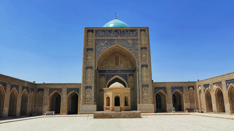
Biketouring journal covering Uzbekistan and the roads from Karakalpakstan to Fergana via a short transit through Tajikistan. On my way I visited the old
Silk Road towns of Khiva, Bukhara and Samarkand.
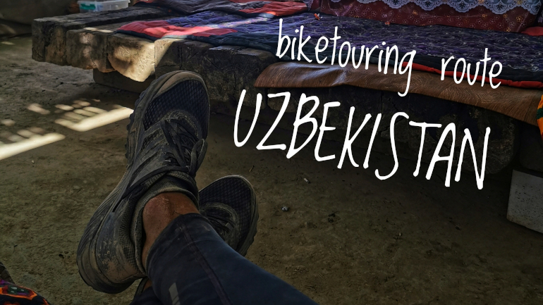
biketouring route uzbekistan
2023-07-03 | itinerary
Biketouring route for Uzbekistan covering the roads from Karakalpakstan and Nukus to Fergana while visiting Khiva, Bukhara and Samarkand on the way.