Contents [hide]
Intro
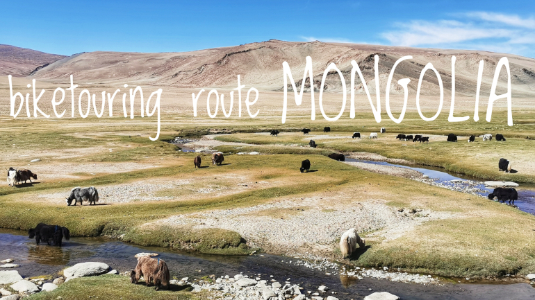
Biketouring route description for Mongolia covering the roads from Khovd Aimag to Zamiin-Udd via Ulaanbaatar including GPX files and an interactive map with points of interest.
GPX files
Get the GPX files here:
Route stats
- Distance (km): 2327
- Total ascent (m): 11406
- Road days: 29
- Highest point (m): 2862
- Time of year (month): September and October
- Navigation app used: Mapy.cz
Highlights
My favorite highlights from Mongolia.
- The rolling steppes
- Ulaanbaatar
- Visiting a ger for lunch
Map with Points of Interest
The map contains points of interest (POI) on the route I cycled. Click on the marker for a detailed description. The list of POIs include places where you can eat, sleep, stock up on water and more. It also shows you where to buy a SIM card and other useful stuff.
The POIs were correct as of October 2023 so take this into consideration when you plan your own travels. Things change fast in this dynamic world. As always, I’m happy to receive feedback if any of the info given is not correct or up to date.
Section 1: From Takashiken (China) to Altai (Mongolia)
- Route: From Takashiken (China) to Altai (Mongolia)
- Distance (km): 647
- Elevation (m): 4595
- Highest point (m a.s.l): 2862
- Days: 9
From the border town of Takashiken in China there’s a short one hour ride to the actual border. Once in Mongolia you’ll immediately notice calm and quiet roads. There is hardly any traffic in comparison to China and their high amount of trucks and heavy traffic. Enjoy it. You have 40ish km to the first town in Mongolia where there are ATMs, banks with money exchange, hotels, grocery shops and mobile operators selling SIM cards. Cycling on the AH4 road is all asphalt of good quality with no cracks or potholes. There are no shoulders but you hardly need one with the low level of traffic.
After Bulgan you can choose to continue on the AH4 heading towards Khovd or you can connect with a more eastern road just before Altai Cum. Both routes will eventually connect with the Khovd-Altai main road but the AH4 should have more micro settlements and mini-markets to stock up on food and water. Also, along the AH4 to the mountain pass, there’s a river running next to the road. You can filter the water for drinking and even take a refreshing bath. I took the AH4 and followed it to the turn off to a town called Must. Great mountain scenery and epic camping spots on the plateau close to the mountain pass. I did not regret taking this route.
There’s a shortcut between Must and Tsetseg which I took to save a longer detour. However, you might want to consider continuing on the AH4 towards Khovd and turn right when you reach the Khovd-Altai main road. I went for the Must-Tsetseg road which was 45 km of bad gravel with frequent washboard surface or loose gravel or large stones. This shortcut truly was demanding and I ended up walking the bike for a larger part of the distance. Nevertheless, it was a very scenic road and I was completely alone. Only one car passed me all day.
Taking the Must-Tsetseg shortcut also gives you another stretch of bad gravel. After Tsetseg you turn straight north to connect with the Khovd-Altai main road. There is a nice asphalt road all the way up to the Khushuut Mine and then you have to endure some 30 km of bumpy gravel road. One advantage of this shortcut is that you have two towns (Must and Tsetseg) where you can restock water and food. If I should do the route choice again I would consider following the AH4 all the way up to the Khovd-Altai main road.
Coming onto the Khovd-Altai main road there’s good asphalt again but no shoulder though. This road is surprisingly quiet. Very little traffic which lets you really enjoy the scenery. From Bulgan to the Khovd-Altai main road there’s a lot of mountain scenery but this gets switched out with a very big and vast plateau which lasts almost all the way to Altai. There’s mountains but they are low and far away on the horizon. The endless infinity landscape is not for everyone but I love it. It’s ocean on land and I can truly empty my mind just grinding mileage.
There’s a small mountain pass just before Altai and then the first real Mongolian city. Until now, there’s only been smaller villages and micro settlements (not considering Bulgan the border town). For some parts I cycled two days to get to a new settlement. Amazing.
If you want a vast, open and empty landscape with no human settlements, then this section of Mongolia is perfect for you. However, you will see some white dots far away and far apart which are locals living in gers. On the hill sides there are large herds of sheeps which, from a distance, looks like a black shade gliding over the landscape. Herders tend their flock of animals on horseback and on motorcycles. You will encounter these herders daily so the landscape is not completely empty for any trace of life. Nature is still overwhelmingly empty.
Make sure to plan your food and water because there will be some larger distances where you can’t restock. Carry water and food for at least two days. Wind is almost constant here and the distances can be very long if you all of the sudden need to battle a headwind the entire day. Bottled water was available in the mini-markets and I could always buy instant noodles. Some places had Mr. Choko Squirrel (a Nutella lookalike) and bread. The eateries will only have a limited selection and I ended up favoring my instant noodles meals and oats for breakfast (I brought oats in from China).
Anyplace is a camping spot so you will definitely not have any difficulties finding a place to pitch a tent. Locals will invite you over to their gers. If you want to be left alone for the night there is also every chance to do so - just go far enough away from any ger. Expect some stony surfaces where you need to sweep the ground for pebbles. Very few places did have solid grass. The ground is compact enough for good anchoring which you need because the wind is a factor here and weather changes quickly. So make sure your tent is firmly anchored down for a good night’s sleep.
Section 2: From Altai to Arvaikheer
- Route: From Altai to Arvaikheer
- Distance (km): 593
- Elevation (m): 3107
- Highest point (m a.s.l): 2169
- Days: 7
Altai is a high elevation city and a thin blanket of snow had, already in September, colored the hillsides white. There’s an option to head north via Uliastai and connect with the northern road. You get to cycle through and over a mountain range and pass Tsetserleg. If I had come a month earlier I would have opted for this route. I’ve heard it should be beautiful. Instead I took the more direct way to Ulaanbaatar.
There is not much change in the scenery. It’s still very much just the standard Mongolian steppe with herders on their motorbikes tending to their flocks. There are still some herders on horseback but they are a minority. Rare white dots (gers) can be seen far away from the road. Besides this you are going to be very alone.
There is hardly any traffic on the road. Mongolia does not build wide roads with a hard shoulder. But there is always a soft gravel shoulder to escape into if you need it which only happens when trucks in opposite directions pass you on the road at the same time. That never happened to me on this part of the route. The asphalt quality is surprisingly good.
Bayankhongor is a bustling city by Mongolian standards. Before you reach it you will see two road choices on the map - a northern and a southern option. Don’t be fooled by Google Maps which marks the southern road as the main one. This one is actually a gravel road. If you want to get off the asphalt road then you take this one but be prepared for possible river crossings. The northern road, going via Buutsagaan, is the main asphalt road.
Once in Bayankhongor you can visit some neglected dinosaur parks which apparently pays tribute to the fact that some very old dinosaur fossils and eggs have been found in Mongolia. There’s apparently two museums in town, but honestly, I looked for them but couldn’t find them. They very well might have been closed. My highlight from Bayankhongor was to climb up the stairs to a Stupa with an awkwardly placed radio mast aka telecommunications tower to get a good view of the city and surroundings below.
From Bayankhongor you cycle towards Arvaikheer and you get up close to the mountain range north of you which offers a few spectacular views as you dip down to Nariinteel. You want to stop at this small settlement to stock up on water, snacks and food. The restaurant mainly serves dumplings here and I found the menus at the eateries to be very limited to such a degree that I gave up asking in the end and just went for snacks at the mini-markets.
Continue onwards to Arvaikheer where I found a cheap hotel room. There’s an Asian restaurant here you might want to try out. They actually serve something other than dumplings. Their menu was impressive and they did have most of it available. The ‘Nomadic Restaurant Pub Hot Pot Karaoke’ (yeah, in Mongolia your establishments are multipurpose functional) is also worth a visit. They have a selection of beers which I liked.
Section 3: From Arvaikheer to Ulaanbaatar
- Route: From Arvaikheer to Ulaanbaatar
- Distance (km): 430
- Elevation (m): 1757
- Highest point (m a.s.l): 2014
- Days: 5
There’s another chance to head north just after Arvaikheer via Khujirt if you want to visit Kharkhorin which is nearby to the old ruins of Karakorum which once served as the capital for the Mongolian Empire. In Kharkhorin you also have the well renowned Erdene Zuu Monastery.
Or if you absolutely don’t want to do any gravel roads with a bad washboard surface, you can continue on the asphalt road as I did. You will connect with the northern road just before Rashaant. If you wonder where all the cars are in Mongolia you will find the answer on this road from Rashaant to Ulaanbaatar. If you can avoid cycling this part on weekends, then I recommend doing so. This road is very busy with traffic.
All of the sudden the narrow roads become a problem. The conservative and non-aggressive drivers I’ve experienced so far were substituted for Nascar driving wannabes who absolutely don't want you on the road. They angrily honk and zoom by you real close. All the way into Ulaanbaatar I had to apply a lot of traffic awareness and cycle into the gravel strip when trucks passed which happened often.
I didn’t enjoy the part from Rashaant to Ulaanbaatar that much. If you are looking for a highlight, then you can visit the Hustai National Park and follow a dirt road into the capital. Many days of rain can make this alternative way very muddy. If you stay on the asphalt road following it into Ulaanbaatar, I can make you happy by telling you that the road turns into a double lane in each direction which gives you some much needed space.
As I approached Ulaanbaatar I was surprised by its size and how modern it is compared to what I’ve seen elsewhere in the country. It’s a metropolis…. Relatively speaking. The capital boasts a population of 1.3M people of a total population of 3.3M in the entire country. These numbers truly make you appreciate just how empty the country is outside of this bustling city.
I stayed a full week in Ulaanbaatar. Mainly because I had to repair a zipper in my tent and find spare parts. There are a lot of outdoor shops and large shopping malls and what you don't find there you might find at the large Black Market aka Narantuul Market. There are plenty of KFCs and Pizza Huts if you have fast food cravings. There are bars and nightclubs if you are beer thirsty and up for a dance. There are coffee shops with real coffee. There are museums and a large Monastery complex well worth a visit. Traffic jams are a problem so you probably will be faster exploring the city on foot.
Section 4: From Ulaanbaatar to Zamiin-Uud
- Route: From Ulaanbaatar to Zamiin-Uud
- Distance (km): 657
- Elevation (m): 1947
- Highest point (m a.s.l): 1755
- Days: 8
Leaving Ulaanbaatar on a bicycle is a challenge with all the dense traffic jams. Better stick to the sidewalks. However, there is a nice way out of the city. Head down to the National Park at the south end of the city. Here you’ll find a pristine bike path over 5 km long. And when you connect with the main road there is another separate bike path all the way to Nalaikh.
After Nalaikh you can continue east towards the Chinggis Khan Statue Complex before backtracking to the southern road leading to the border town of Zamiin-Uud. On the way you’ll pass Choir and Sainshand as the bigger towns before entering China.
You are not allowed to cross the border on a bicycle so you will need to catch a bus in Zamiin-Uud.
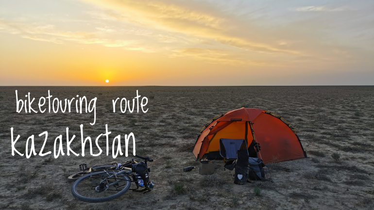
biketouring route kazakhstan
2023-08-16 | itinerary
Biketouring route description for Kazakhstan covering the roads from Kuryk to Beyneu via Beket-Ata with a crossing of the Ustyurt plateau and from Almaty to
Zharkent cycling over the Assy Plateau. The article includes GPX files and an interactiv...