Contents [hide]
Intro
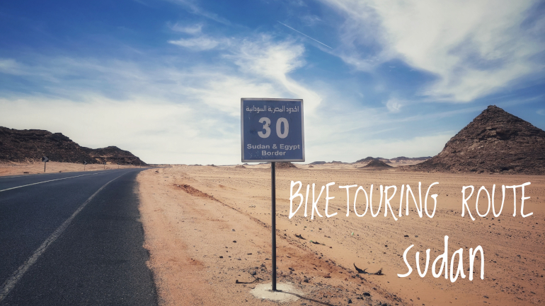
ATTENTION: I cycled in Sudan in April 2023 when a war broke out between the national military and rebel forces and I had to stop midways and escape to safety. Before you enter the country, please double check the current situation with your own foreign ministry and ideally with local people on the route you plan to follow.
Sudan is a flat and arid country. A golden desert landscape dominates much of the route and the green vegetation you’ll see will be following the winding Nile river. It’s a very hot country so be sure to time your visit unless you have a high aptitude for handling scorching temperatures.
The country offers a surprising amount of pyramids. Although they are not as well kept as the ones in Egypt you will be able to enjoy them almost in solitude. But the pyramids are not the main draw. A friendly and welcoming local population with a mix of sleepy and vibrant villages along the Nile river are the main highlights in my opinion.
My plan was to cross Sudan from north to south entering from Egypt and leaving to Ethiopia as part of the Cairo to Cape trail. I got interrupted midways in Karima as a war broke out and I have a heartfelt and deep wish for peace. Once things have stabilized and you get the opportunity don’t hesitate to visit this country and feel the warm welcome from the smiling Sudanese.
GPX files
Route stats
- Distance (km): 659
- Total ascent (m): 1.251
- Road days: 10
- Highest point (m): 332
- Time of year (month): April
- Navigation app used: Mapy.cz
Highlights
My favorite highlights from Sudan. Consider visiting these on your tour.
- Relaxing at the roadside cafeterias and hanging out with the locals there
- Stopping in the vibrant river towns of Abri and Dongola
- The empty desert road from Dongola to Karima
Map
The map contains points of interest (POI) on the route I took from Abu Simbel in Egypt to Karima in Sudan. Click on the marker for a detailed description. The list of POIs include places where you can eat, sleep and stock up on water together with places that offer shadecover. It also shows you where to buy a SIM card, do the registration and other useful stuff.
The POIs were correct as of April 2023 so take this into consideration when you plan your own travels. Things change fast in this dynamic world. As always, I’m happy to receive feedback if any of the info given is not correct or up to date.
Section 1: Abu Simbel (Egypt) to Abri (Sudan)
- Route: Abu Simbel (Egypt) to Abri (Sudan)
- Distance (km): 242
- Elevation (m): 682
- Highest point (m a.s.l): 335
- Days: 4
When you travel from Egypt to Sudan, then you will most likely pass through Abu Simbel in Egypt and cross Lake Nasser to reach Qustul on the east side. You can avoid crossing the lake by following the road on the west side after it splits down to Abu Simbel. I have not heard about doing the border crossing on the west side and you will also not have any city pits tops between Aswan in Egypt and Abri in Sudan for a total distance of 490 km. If anybody did this I am eager to hear about the experience. The ferry crossing is free and should run regularly through the day. Ask once you get to Abu Simbel for departure times. If you are lucky someone can confirm a schedule. I was not that lucky so I just went early in the morning. I was there at 7:30 and the ferry departed at 9:30 after spending some time offloading and onloading trucks. Once on the other side there is no police escort and a very quiet road with a wide shoulder for 35 km until the border between Egypt and Sudan.
From the border crossing there is only 35 km to Wadi Halfa. The road is narrow with no hard shoulder but there's the option to ride in a one meter wide gravel strip which acts as a decent shoulder. The road is very quiet as only a trickle of cars and trucks passes once in a while from the border. It's all empty golden sand landscape until you reach Wadi Halfa. Here you'll find plenty of accommodation options (all basic ones) and it's a good place to stock up on water and food for the road to Abri. Here you can also do the mandatory registration and get a SIM card.
From Wadi Halfa to Abri there is pretty much just an empty golden desert with some black rocky mountains. The distance is 180 km. Beautiful scenery and very peaceful. The road is narrow with no shoulder. You can escape onto a strip of gravel if space on the road gets too cramped. But I hardly think that would ever happen. Only a few cars and trucks passed me in either direction every hour. The roads are very quiet (perhaps extra quiet since I cycled during Ramadan).
After some 50 km from Wadi Halfa you pass a shelter with a big water reservoir. I definitely would advise to filter the water if you decide to drink it. The place is good for shade, rest and making new friends since most vehicles make a stop there.
66 km from Wadi Halfa you can find some shade in a flood tunnel high enough to stand inside. It could also work as a camp spot for the night and it was actually not too dirty when I looked inside.
Perhaps best to continue on for some extra kilometers because 91 km from Wadi Halfa you'll pass a Caféteria run by very nice and friendly people. They have cold drinks, hot meals and a place to pitch your tent (they also have some very basic beds without a mattress if you're up for it). 4km after there's another Caféteria if the first one for some reason has no space for your tent or has run out of water.
After 124 km from Wadi Halfa you'll see the first sign of civilization when you pass a bunch of small squared tin structures that make up a rather busy pit stop. Fruits, groceries and food is available here but I wouldn't recommend this a place to camp for the night. If you plan to make a stop here for the night you can try out the storm flood tunnel just out of town, but when I went there they were occupied by locals.
On the 162 km mark from Wadi Halfa the Nile suddenly reappears and there's a green and lush stretch of farmed land following the bends of the river. Here you also have your last option for a Caféteria rest before you reach Abri. This one is rather big and has plenty of beds for you to take a well deserved rest. Close to the Caféteria you can choose to take a gravel road, all the way to Abri, which runs between the village mud brick houses as an alternative to the main road. It's slow biking but very rewarding since you get to meet so many smiling and welcoming Sudanese.
In Abri there are only a few guesthouses and the Nubian Guesthouse is overpriced in my opinion. You can bargain to pitch your tent for a small fee. In Abri there's an option to change money at the local bank. Abri is more busy at night than you would think and it's beautifully located on the riverbank of the Nile. Not a bad place to take a short rest.
Section 2: Abri to Karima
- Route: Abri to Karima
- Distance (km): 417
- Elevation (m): 569
- Highest point (m a.s.l): 332
- Days: 6
From Abri to Wawa (46 km) you have an option to follow a gravel road that runs parallel to the main asphalt road. There's not much to be gained distance wise. You do get to be closer to, and if you choose, dart in between the mud brick houses of the small villages you pass. Even though you are very close to the Nile you don't actually see it from the roads. Rather you have a lush green barrier shielding any river view. Pick the gravel road if you want to wave and say hello to the locals. Although, on a hot day, not many are out strolling the dusty village so there's sort of a ghost town vibe. You'll find the occasional mini-shop and shelter with water jars. Bring enough water for a full day just to be sure. Just after Wawa you can take a rest in the Abdu Rabbo Guesthouse. It's a basic good-value-for-money place. Very clean, has spacious rooms, shared shower and open-air (four walls no roof) squat toilet. A five minutes walk from the guesthouse you have a Caféteria with a small selection of groceries, cold drinks and hot meals served at night. This is a good place to call it a day if you want to explore the Soleb temple on the other side of the river.
Just after Wawa there is a tiny short stretch of river view. Enjoy it because it's not going to last long. Instead the landscape turns into something like the moon. Greyish and black rocks dominate instead of the golden sand and it's pretty empty with no sign of civilization. 80 km after Abri heading south you can shop for water and food at dusty shopping street Sudanese style (it's marked on the map below). It's worth the experience going there just for the fun of it. At the very end of the shopping street there's a gold shop. Go have a look. The owner is super cool and can tell you how they extract gold from the area. Also try to look inland to get a glimpse of people with metal detectors which are actually gold detectors.
At Delgo there's a police checkpoint. I only showed a digital copy of my passport which was fine. 121 km from Abri there's a couple of Caféterias with food, cold beverages and beds. Be aware, they might try to rip you off on food prices. Continue 12 km further down the road to reach another set of Caféterias where you are very welcome to pitch your tent as well but they will probably try to make you pay for it the following morning.
From these Caféterias it's an easy part until Kerma (172 km from Abri) and you still continue along the same empty landscape which bores some and other find fascinatingly amazing (I belong to the last category). If you get a good tailwind you can continue all the way to Dongola and make it in one day if you camped for the night at one of the Caféterias just mentioned above. Dongola is some 55 km down the road from Kerma. In Kerma you can pop in and stock up on supplies. This is the first town with decently equipped grocery stores since Abri. Kerma also has something called Deffufa which is an old massive mudbrick temple. If you decide to stay for the night in Kerma, the Nile Hotel is an affordable place and relatively clean.
From Kerma to Dongola you say goodbye to the empty desert landscape. There is more farmed land and more of an urban setting. There's the option to take the backroads of the town and villages for most part of the way to Dongola. I was done with dusty roads so I kept to the asphalt paved ones and went onto the highway just after Argo.
The traffic picked up after Abri and definitely after Kerma. As is characteristic for Sudanese highways and main roads, there are no hard shoulder but you can swing away from the road and onto flat gravel if needed. The drivers are generally good at giving plenty of space for cyclists at the side of the road. Perhaps it's because they are used to pass donkey driven wheel carts.
Dongola is a good place to exchange money and stock up on water and food if you are taking the road to Karima. Dongola has a larger veggie market which is worth a visit.
From Dongola to Karima there is 180 km of nothingness. I would advise to bring food and water for two days just to be prepared for the unforeseen. 88 km after Dongola there is a small Caféteria selling only tea, coffee and snacks. You can get water from clay jars so up to you if you want to rely on this pitstop to refill your water bottles for the next day.
20 km after Dongola the empty golden desert landscape begins and continues all the way to Karima. You see a handful of houses on your way but they all seem abandoned. The roads are very very quiet and only a few cars passed me all day. There's plenty of opportunity to get in a zone and enjoy the scenery as you float along this ocean of sand. Be aware though that winds can be fierce on this flat desert plain. I actually had a mobile data connection along some parts of the road although it was just enough to receive and send WhatsApp messages.
planning and travel toolkit sudan
2023-04-19 | toolkit
A biketouring guide for Sudan helping you out with practicalities of any trip to this east african country. Based on personal experiences.
biketouring kazakhstan
2023-06-03 | blog
Biketouring blog covering Kazakhstan and the roads from Kuryk to Beyneu. I cycle across the Ustyurt Plateau via the underground Mosque and pilgrimage
place of Beket Ata before heading for the Tazhen border crossing between Kazakhstan and Uzbekistan