Contents [hide]
Intro
If you do the entire Beyneu Samarkand stretch you have to have a thing for long and flat roads in desert landscapes - because there is not much else. Also if you are timing your entry to the mountain regions to the east you will probably do Uzbekistan in May or June where temperatures already hover around 40. A certain aptitude for handling heat is required if you are going to make it through.
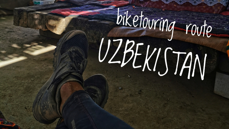
Cycling across Uzbekistan will earn you a certain degree of a legit Silk Road Traveler and I certainly found peace and tranquility in the daily mileage grind along the desert roads. It’s all flat so you don’t have to fight against the elevation but you will have wind, sand and dust.
For me Uzbekistan was all about the friendliest people, a ton of water melons and spectacular Silk Road Old Towns with their trademark architecture. Read on for my trip report covering the roads from the desert plains of Karakalpakstan in the west to the lush farmland valley of Fergana in the east.
GPX files
Get the GPX files here:
Route stats
- Distance (km): 2100
- Total elevation (m): 3853
- Road days: 23
- Highest point (m): 911
- Time of year (month): June
- Navigation app used: Mapy.cz
Highlights
My favorite highlights from Uzbekistan are centered around the ancient Silk Road old towns. I guess the long straight desert roads were a highlight in itself because it let me stop at every roadside cafeteria I passed to re-supply water and take shade from the scorching sun - I met a lot of super friendly locals this way.
- The old town of Khiva
- The old town of Bukhara
- The old town of Samarkand
- Every roadside cafeteria eating laghman and drinking tea
Map with Points of Interest
The map contains points of interest (POI) on the route I cycled. Click on the marker for a detailed description. The list of POIs include places where you can eat, sleep, stock up on water and more. It also shows you where to buy a SIM card and other useful stuff.
The POIs were correct as of June 2023 so take this into consideration when you plan your own travels. Things change fast in this dynamic world. As always, I’m happy to receive feedback if any of the info given is not correct or up to date.
Section 1: From Beyneu (Kazakhstan) via Tazhen border crossing to Nukus (Uzbekistan)
- Route: From Beyneu (Kazakhstan) via Tazhen border crossing to Nukus (Uzbekistan)
- Distance (km): 518
- Elevation (m): 269
- Highest point (m a.s.l): 200
- Days: 6
There is no change in scenery from Kazakhstan. It’s still all flat and arid. There is not much to see but an empty and open landscape with a few camels. If you have been cycling in Kazakhstan you might already have seen enough of this repetitive nature. There is a train option from Beyneu to Nukus you can consider if you want to skip it. For me however, being in a vast and empty landscape without many traces of civilization is a rare opportunity and I didn’t think twice about taking an extra week to cycle this stretch. To make it easy for you, I’ve marked all the places that I think would be relevant. Hotels, wild camp spots, eateries and most important where to get water.
If you cycle here during summer months your main concern might be if there is frequent access to water. Don’t worry. You should pass a roadside shop or cafeteria daily depending on your mileage. Carrying your minimum need of water for two days should suffice if you want to be on the safe side. The longest stretch without access to water is 113 km (between Jasliq and Qirqqiz). Daily consumption of water is highly individual. Optimally, I drink 6-8 liters on days where temperatures get close to 40 degrees. 4 liters would be an absolute minimum. If you should lack water, there is always the option to flag down a passing truck. They will pass you very often and usually carry a lot of water.
At the border there are hotels on both sides. I asked for prices at the hotel on the Uzbekistan side and they charge 20 USD for a room without any shower (but they do have WiFi). Heavily overpriced! However there is a great cafeteria to get some food and also some small shops selling water. I did a late border crossing and ended up camping 12 km from the border which was no issue.
There should be money exchangers around on the Uzbekistan side but I changed dollars to Uzbek local currency on the Kazakhstan side just outside the gate in the queue. I got close to the market rate. The difference between the market rate to the street rate was 3 USD on an exchange of 100 USD. A fair commission if you ask me. I saw no ATMs so I brought cash to exchange. The next bigger city is far away.
From the border to Jasliq: Once you hit the roads in Uzbekistan after crossing the border you realize all the horror stories were true. The roads are some of the worst I’ve ever seen. You can hardly cycle them at all. When I had the option to, I chose the parallel gravel road which runs just next to the main road. It’s a dusty experience. But it’s not all bad news. Construction on a new road all the way to Jasliq is in progress. As of summer 2023 the road was not officially open and work was less than half done but I could still cycle the empty road which ranged from being flat and very smooth gravel to completed concrete road sections. As time goes on, the road condition will only get better for future cyclists so the stories about the horrendous bad Uzbek roads are soon a thing of the past.
The official rule states that you have 72 hours to register yourself at a hotel after entering the country unless you manage to do it via their website platform. I picked a hotel along the road just outside Jasliq to get my white registration paper slip. You can easily reach this hotel before the registration deadline. I paid 8 USD (2023 prices) for a private room with shower and air conditioning.
From Jasliq to Nukus: After leaving Jasliq you have your longest unsupported stretch with 113 km to Qirqqiz. There is no shade and no place to get water. The asphalt road gets better as soon as you leave Jasliq but there are still parts with horrendous bad tarmac and giant potholes. I ended up pushing my bicycle on these short parts. The asphalt road after Qirqqiz to Kungrad is nice and smooth with a narrow hard shoulder which allows some faster cycling. Qirqqiz is a little community of houses built to support the big UGCC factory nearby. They have some smaller shops where you can get water and groceries. I was told there were three grocery shops in town. The larger “supermarket” opens at around 11 and the smallest shop, which I used, opens at 9. Take this into consideration if you plan to arrive early. After Qirqqiz you have a short ride of 23 km until you reach Elabad with a large and busy cafeteria. A further 48 km brings you to Kungrad which is a relatively bustling city compared to the other places you pass along the road from Kazakhstan.
From Kungrad to Nukus: I could have detoured to Muynak from Kungrad to experience the old shoreline of the Aral Sea from 1960. Instead I went on the shortest route to Nukus. It was a boring road with frequent urban settlements. Compared to the Beyneu-Kongrad stretch this road is surprisingly green and looks like a giant oasis in comparison. There are plenty of bus stops with shaded seating areas. I passed one cafeteria about halfway to Nukus where I got a hot meal and water. I’m sure there are other places as well to get water if you head off from the main road and into one of the small settlements. However, the halfway cafeteria sufficed for me as you can cover Kungrad to Nukus in one long day. The asphalt road is in good condition with only a few minor cracks until you are 30 km from Nukus. Here the road loses its shoulder and gets very uneven with loads of potholes. I often cycled in the gravel strip next to the asphalt road. Also, the traffic increases a lot from an otherwise relatively calm road. I didn’t spot any suitable places to camp along the road and I would suggest heading for a room in Nukus.
A big adventurous detour to the Aral Sea, which once was the fourth largest lake in the world, is possible if you are up for some gravel and off road cycling……
Section 2: From Nukus to Khiva
- Route: From Nukus to Khiva
- Distance (km): 177
- Elevation (m): 207
- Highest point (m a.s.l): 118
- Days: 2
There’s supposed to be a double lane road in each direction on the A380 but road construction was in progress as of June 2023. When finished you should have a smooth concrete paved road until you turn off for Khiva. At the first turn off to Khiva (named 4R-181 on OpenStreetMap) just as you leave the A380 you are bound for some sorry excuses for a road. But you are perhaps by now well used to the poor quality of Uzbeck roads. Be prepared for some bumpy kilometers.
The scenery along the highway doesn’t change much. All very flat with green stubby desert landscape. You only need to bring water for a day because at the first turnoff road to Khiva (4R-181) you will have a strip of cafeterias. Here fish is a big thing on the menu. You will soon cross the river on some dodgy patchwork of a metal floating bridge to a large area of farm fields which continue all the way into Khiva.
For me it was two days of cycling to Khiva from Nukus and I found a camping spot next to Gyaur Kala which is one of many old mudbrick fortresses in the area. Your best bet for a camp spot is in this area along the river or along the A380 before the turnoff. Because once you start cycling towards Khiva from the river, there is not much open land. Once in Khiva you have arrived at one the main highlights of Uzbekistan. A well preserved old silk road town. It’s well worth a full day of exploring. Just expect a lot of tourists.
A detour is possible to Elliq-Qala which translates to Fifty Fortresses. They are the remains of very old walled towns, palaces and forts mainly situated east and north of Urgench. Don’t expect much more than some half melted mud brick structures at best but they are an interesting insight to an ancient civilization and give you something to look at along an otherwise bleak and boring highway. Instead of turning off at 4R-181 you continue along to Bustan on A380. Before Bustan you will pass Toprak-Kala which was the main temple complex of the Khorezm Kings. Ayaz-Kala is some 23 km north of Bustan and offers a good opportunity for a scenic wild camp. You can take a road from Bustan to Ayaz-Kala and backtrack the same way. If you are not the backtracking kind of person, then there’s a net of gravel roads starting close to Toprak-Kala which ends at Ayaz-Kala where you can connect with the road to Bustan.
Section 3: From Khiva to Bukhara
- Route: From Khiva to Bukhara
- Distance (km): 451
- Elevation (m): 359
- Highest point (m a.s.l): 228
- Days: 5
This is another empty stretch of Uzbek desert landscape. The A380 is in good condition with smooth concrete paved roads and a narrow hard shoulder enough to fit your bike. The roads are flat with only a few mildly sloped hills. Wind can be a factor. In the summer heat is a brutal enemy hitting you with +40 degrees on the bad days. The monotonous landscape can seem like the most boring thing. It’s a busy road with a load of heavy traffic. Big trucks passing you often takes some of the joy from enjoying the landscape. So make up your mind if you already had enough of this landscape because there is a train option from Khiva to Bukhara. But if you do decide to cycle it you will be cheered on by the Uzbek and if you are lucky a police car will pull you over just to give you water (that happened to me).
This is a 3 to 5 days cycling ride depending on your speed. You don’t need to worry so much about water and food. Just bring enough water for a day. I ate all my food at the cafeterias so I didn’t bring any myself. Even though you are on a slow pace you will pass at least one mini market or cafeteria daily. During the summer heat I cycled from early morning and then found a nice cafeteria at midday to rest for 5 hours before cycling the second part of the day. The cafeterias have sitting platforms which are really good for taking a well deserved nap or rest. You will also find that hanging out at the cafeterias is an excellent way of bonding with the locals. Even though you don’t enjoy the road and scenery too much, your cafeteria hangouts will bring some positive mood lifting spirits.
Wild camping should be easy in the open landscape. The ground is a bit more loose sand so anchoring down can be a challenge but not impossible. However, I camped at the roadside cafeterias so I could end my day with dinner and begin the following day with breakfast. I either got to pitch my tent just next to the cafeteria or I was allowed to sleep on the sitting platforms outside.
The good roads and open scenery will end when you get closer to Bukhara. Last part is in urban settlements with bad roads. It seems like Uzbekistan is giving their roads a big tune up because here as well they were constructing new roads (June 2023). If you make it all the way to Bukhara, clap yourself on the shoulder. You are becoming a full fledged silk road traveler. In Bukhara you can enjoy some more old towns in the classic architecture and like Khiva I recommend you stay at least one full day.
A small disclaimer: I broke a spoke 200 km from Bukhara and had to hitch a ride into the city. So the last part I didn’t cycle but only saw from the car seat.
Section 4: From Bukhara to Samarkand and the border with Tajikistan
- Route: From Bukhara to Samarkand and the border with Tajikistan
- Distance (km): 571
- Elevation (m): 1311
- Highest point (m a.s.l): 838
- Days: 6
From Bukhara there’s actually an alternative to the highway which is not too bad in terms of road quality and it does not add to your mileage to reach Samarkand. Out of Bukhara head straight for the south side of the Tudakul Lake. Exiting Bukhara is easy and you’ll soon be on almost car free roads riding in desert landscape if you look to one side and lush green vegetation on the other side. Well it’s not super rich green vegetation but relative to the desert landscape of Uzbekistan it looks like a rainforest. The quality of the asphalt goes from smooth tarmac to rough stony but it’s all in all acceptable for faster cycling.
After the lake and shortly before you reach Navoi you will be greeted by some mountains to your left. Before Navoi is your last chance to find some open landscape to pitch your tent. Stop by Navoi to stock up on water or take the gravel backroads via Karnab if you’re up for a smaller detour.
Once you’ve passed Navoi it’s all farmland. You could be tempted to go for the highway but instead try out the village backroads south of the highway. Some of the roads just next to the railroad tracks are bad bumpy gravel but they do not last forever. When you go a bit away from the rail road and start to zigzag the village roads you can find the smoothest asphalt roads in Uzbekistan. Follow these as long as you can and enjoy the cheers from the locals.
You will have no trouble finding food and water after Navoi. However, finding a place to camp might prove difficult if you can’t make it to Samarkand in one day. Be a bit creative. Ask local farmers if you can pitch a tent in their field. Ask locals if you can pitch your tent in their garden. Or find a local football pitch. You will perhaps be surprised about just how hospital the Uzbeck are. My bet is that you will have no issues finding a spot for your tent.
Once you reach Samarkand you are in an old Silk Road town with amazing madrasas at the Registan square. Take a few days in the city. It has a really nice vibe
Leaving Samarkand was easy. There was a bike lane almost all the way out of town. Rest of the day was in an urban setting. Halfway through some 40 km from Samarkand it started to open up and small hilly mountains appeared with some open landscape.
There were plenty of places all along the way to eat and buy water. It was first at the very end of the day that there was a good opportunity to pitch a tent. I took the first and best spot next to a river 80 km from Samarkand.
The next couple of days are quite boring. The hilly mountains are gone and back are the flat farmfields. There are no good wild camp options along the road. You are also cycling very close to a border region so I wouldn’t advise pitching a tent here. I slept two days at cafeterias and restaurants along the way. One night I slept directly on a sitting platform and the second night I pitched a tent in the restaurant backyard. The road quality is only good for a short while and then turns back into your normal slow and bumpy Uzbeck standard but you will get treated with some decent stretches with pristine fresh asphalt (as long as it may last). If you decide to take the shortest road to Kyrgyzstan you will head through Tajikistan for a very short while. I also needed to do this because my 30 days free visa period was running out. On the Tajik side until Khujan the road is a dream compared to Uzbek road. Smooth asphalt and a wide shoulder.
Section 5: From Tajikistan to Kyrgyzstan via Fergana
- Route: From Tajikistan to Kyrgyzstan via Fergana
- Distance (km): 383
- Elevation (m): 1707
- Highest point (m a.s.l): 911
- Days: 4
My transit through Tajik only lasted two days with one night at a hotel in Khujand. Back in Uzbekistan you cycle through the last part of the lush Fergana Valley and you will cycle next to farmfields and fruit trees for the next few days.
I crossed this part of Uzbekistan in three days. The most interesting part of this stretch is the friendly people you’ll meet. Besides that it was just transport days for me on flat roads along farm fields. Here, the asphalt is surprisingly good considering it is in Uzbekistan. I asked locals to pitch my tent next to a football field one night which was all good and I’m sure the first farmer you ask will give you permission to sleep in between their fruit trees.
Fergana in itself is perhaps the least Uzbek city you will see. It is modern and a bit upscale but serves as a good spot for hotel accommodation if you need a resting day in a room. When you close in on the border to Kyrgyzstan you will begin to see the mountains rise up.
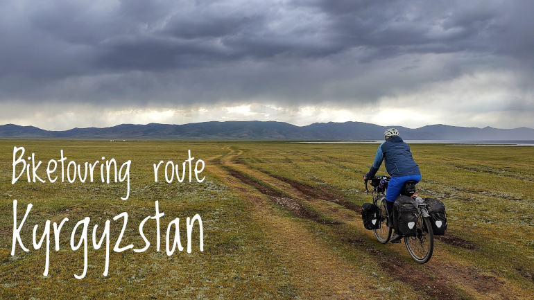
biketouring route kyrgyzstan
2023-07-22 | itinerary
Biketouring route for Kyrgyzstan covering the roads from Osh to Bishkek. I cycled over the Kaldama Pass to Kazarman and continued Son-Kul going over the
Kara-Keche Pass and Kalmam-Ashuu Pass before doing a long downhill section to Kochkor and on...
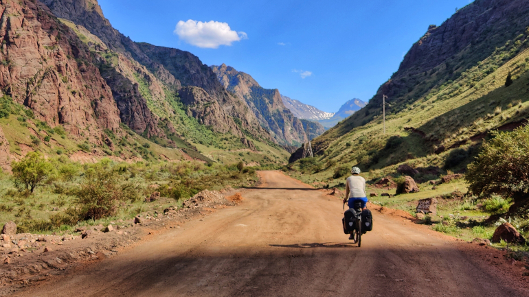
biketouring journal kyrgyzstan
2023-08-04 | blog
Biketouring journal covering Kyrgyzstan and the roads from Osh to Bishkek. I cycled over the Kaldama Pass and Kara-Keche Pass to Son-Kul Lake and
onwards over the Kalmak-Ashuu Pass to Kochkor.